
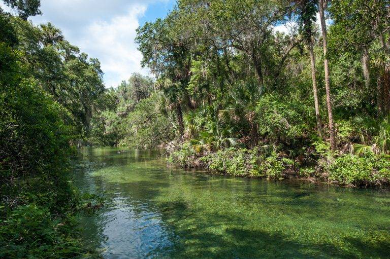
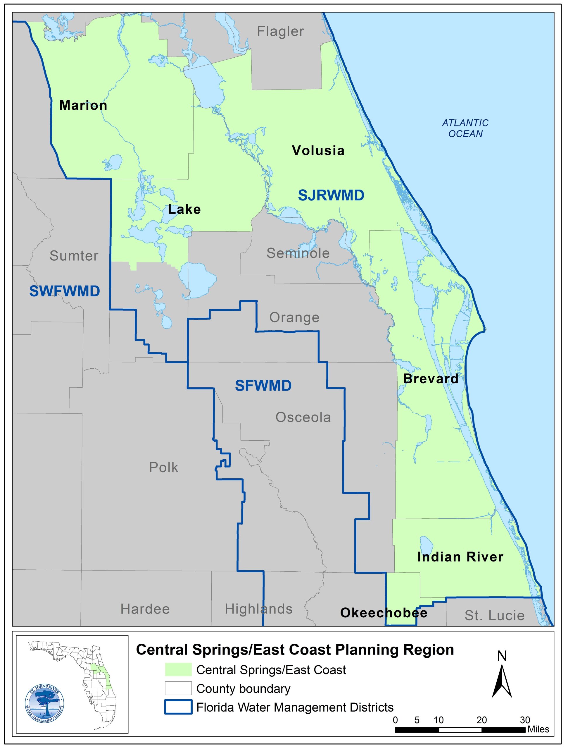
 The Central Springs/East Coast (CSEC) Regional Water Supply Plan (RWSP) area includes all or part of six counties in the St. Johns River Water Management District — Volusia, northern Lake, Marion, Brevard (excluding the city of Cocoa service area, which is included in the Central Florida Water Initiative), Indian River, and Okeechobee counties. The northern portion of the planning region is home to six of the eight Outstanding Florida Springs in the District including Silver and Silver Glen in Marion County, Alexander in Lake County, and Volusia Blue, DeLeon, and Gemini in Volusia County. The CSEC planning region features the headwaters of the St. Johns River, the Indian River Lagoon and more than 140 miles of Atlantic coastline.
The District conducts water supply planning in collaboration with local governments, public supply utilities, environmental advocates, neighboring water management districts, and other stakeholders for a 20-year planning period. Based on the best data and research available at the time of plan development, the 2022 CSEC RWSP indicated that fresh groundwater alone could not supply the projected increase in water demand in 2040 without causing unacceptable harm to water resources. The plan identified solutions, including water supply and water resource development projects and water conservation potential, to meet future needs while protecting the region’s natural resources.
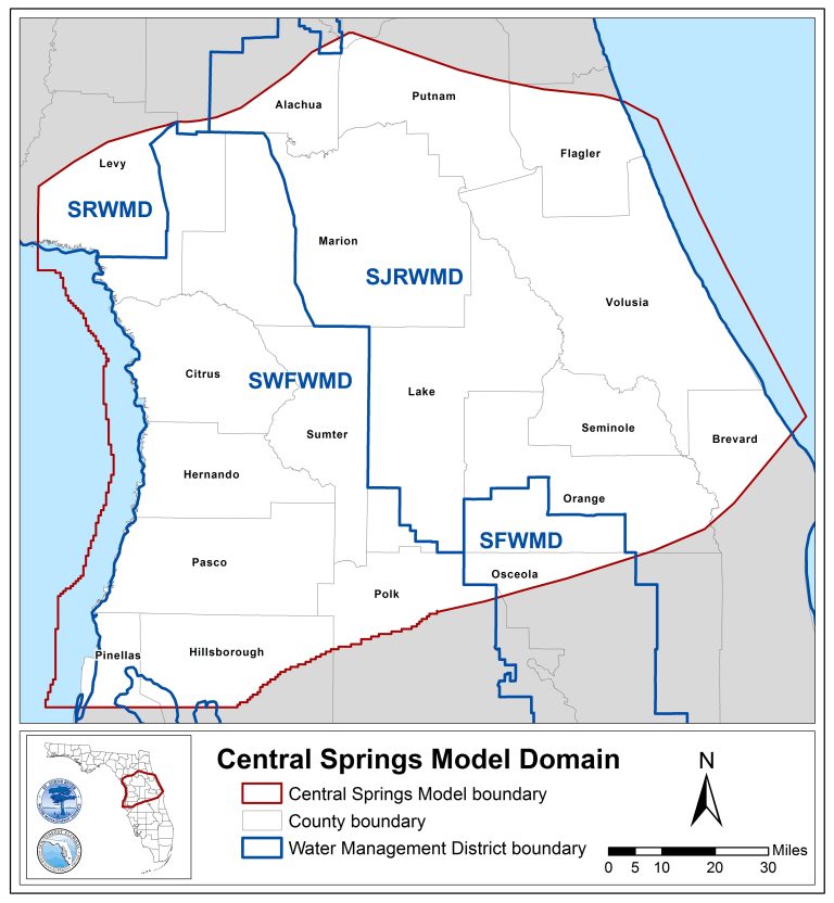
Preparation of the 2027 five-year update to the CSEC RWSP is currently underway. This update will evaluate projected water demand extending to the 2050 planning horizon. New groundwater models will be utilized in the CSEC water resource assessment. The Central Springs Groundwater Flow Model version 1.1 (CSM v1.1) will replace the Northern District Model version 5 (NDMv5) and the Volusia Groundwater Flow Model that were used in the 2022 plan. In addition, the Southern District Density Dependent Groundwater Flow and Transport Model (S3DM) will allow for predictive water quality scenarios in areas of the planning region where saltwater intrusion is a concern. An effort to update several minimum flows and levels (MFLs) lake surface water models will yield revised compliance assessments that will be integrated into the water resource assessment, in addition to any new or re-evaluated MFLs. These tools and others will help to assess whether available water supplies can meet the demands of the CSEC region without causing unacceptable harm to water resources.
Sign up to receive information about the CSEC RWSP by email.
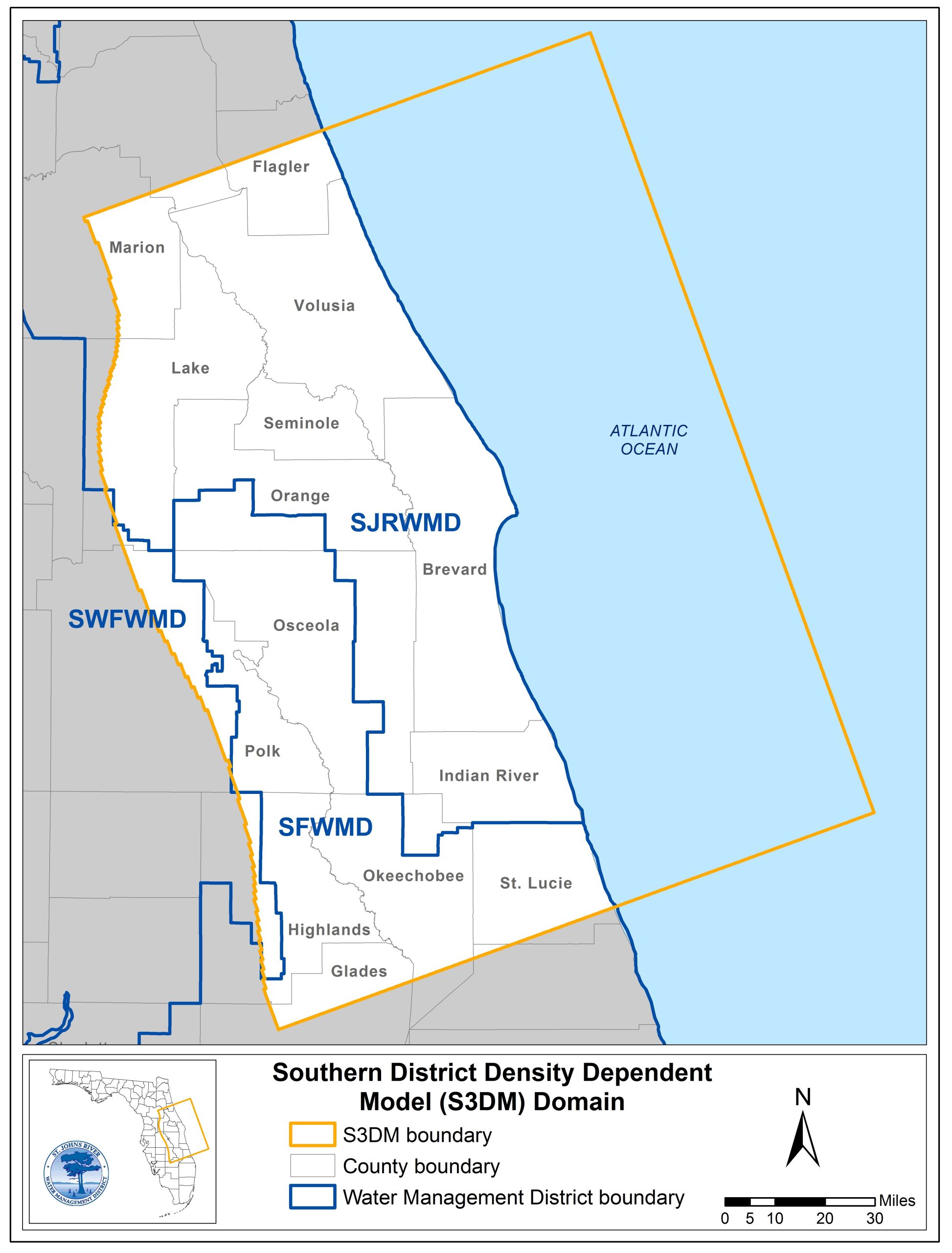 Groundwater quality, mainly along coastal communities, has been degraded in some parts of Florida primarily due to saltwater intrusion resulting from increased groundwater withdrawals. In addition, sea-level rise and other aspects of climate change have the potential to exacerbate this problem. To better understand these issues, the District and its contractors developed the Southern District Density-Dependent Groundwater Flow and Transport Model (S3DM). The S3DM will be utilized as a regional water supply planning tool to evaluate the potential effects of future pumping and climate change, including sea level rise, on water quality associated with saltwater intrusion in the coastal portion of the CSEC planning region. For more information or access to the model files, please contact Lanie Sisco at lsisco@sjrwmd.com.